
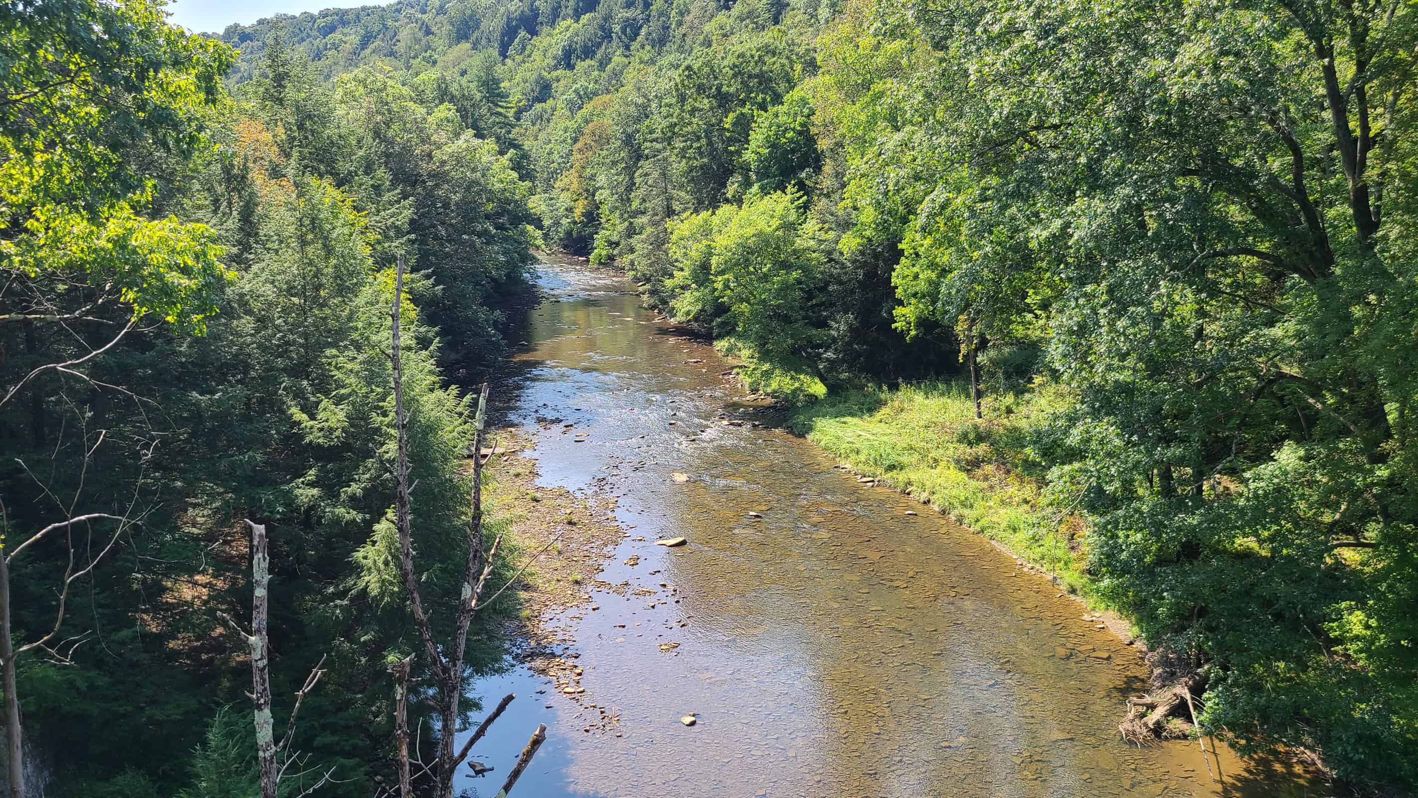
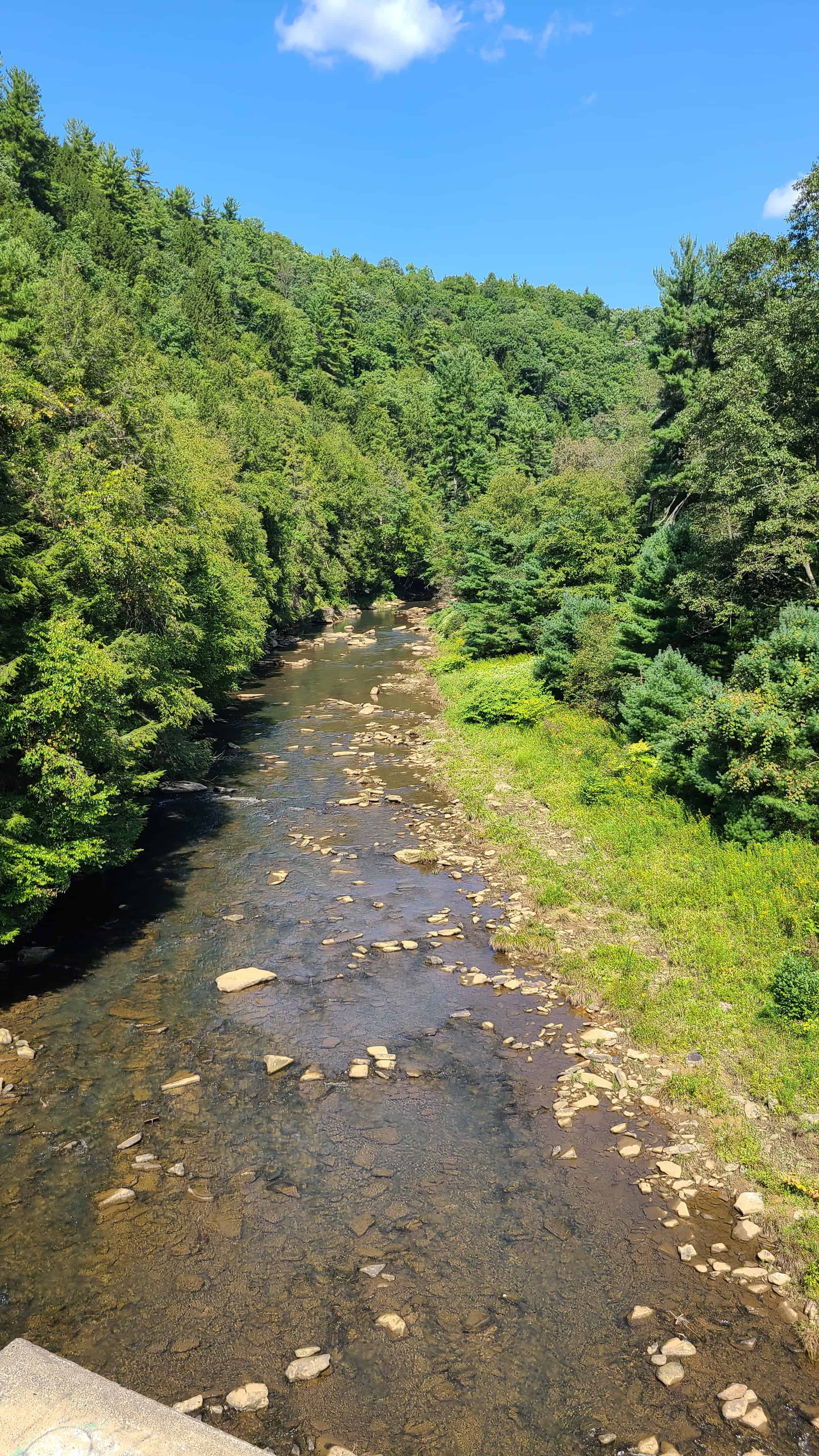
I was blown away by the beauty of the Sandy Creek Trail. Located in western Pennsylvania, about halfway between Franklin and Clarion, the Sandy Creek Trail links up with the Allegheny River Trail and the Clarion Highlands Trail (almost). If photographing creeks, bridges, and/or and valleys is your thing, you’ve found your new home!
History
The history of the trail goes way back to the old Jamestown, Franklin, & Clearfield Railroad. Around 1907, the railroad was expanded through the area to capitalize on nearby oil and coal reserves. Like so many railroads, the 20th century saw a malestrom of consolidations and bankruptcies, and after becoming part of the Penn Central, the line was ultimately abandoned in the 1980s.
In 1991, the Allegheny Valley Trails Associations received a donation of 19 miles of former track. kicked off work to bring the line up to modern rail trail standards. The route was cleared, bridges were made safe, and Mays Mill Tunnel was rehabilitated. The trail opened in 2005 and has become an important ride for anyone looking to explore the area.
There’s talk of one day expanding the trail towards Polk, but this is far from a certainty. Western Pennsylvania, including the AVTA, is currently working hard to build a network of inter-connected rail trails, and the Sandy Creek would play an important role in that journey.
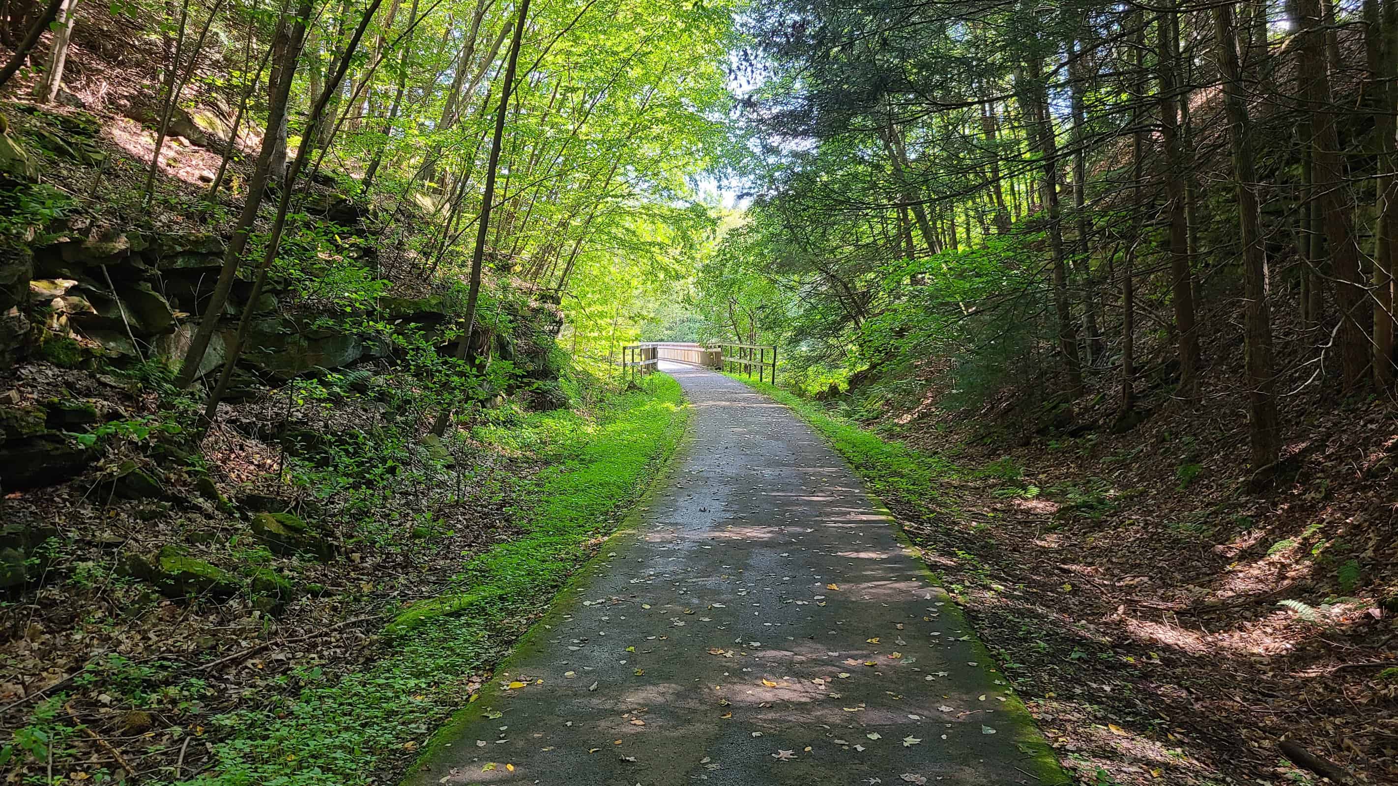
The Trail
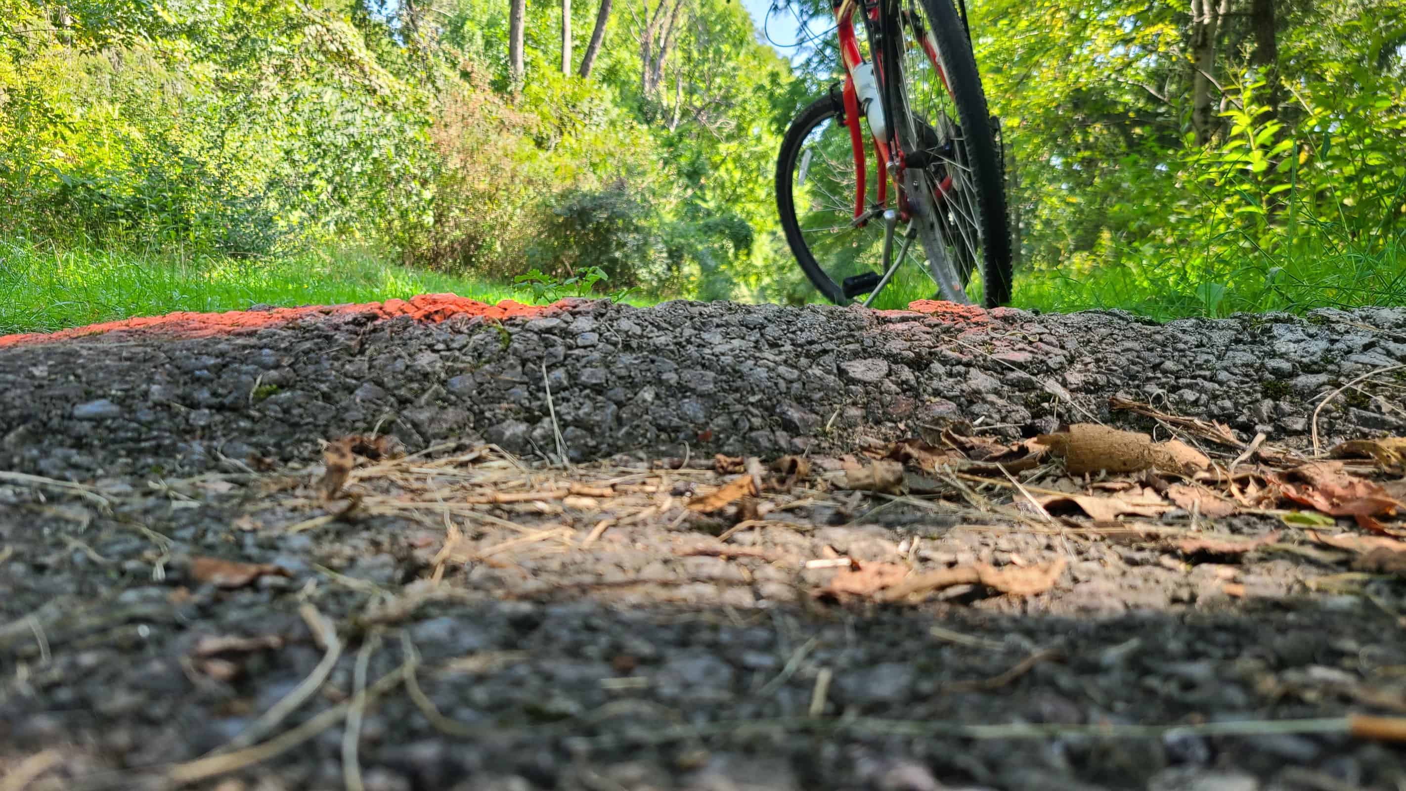
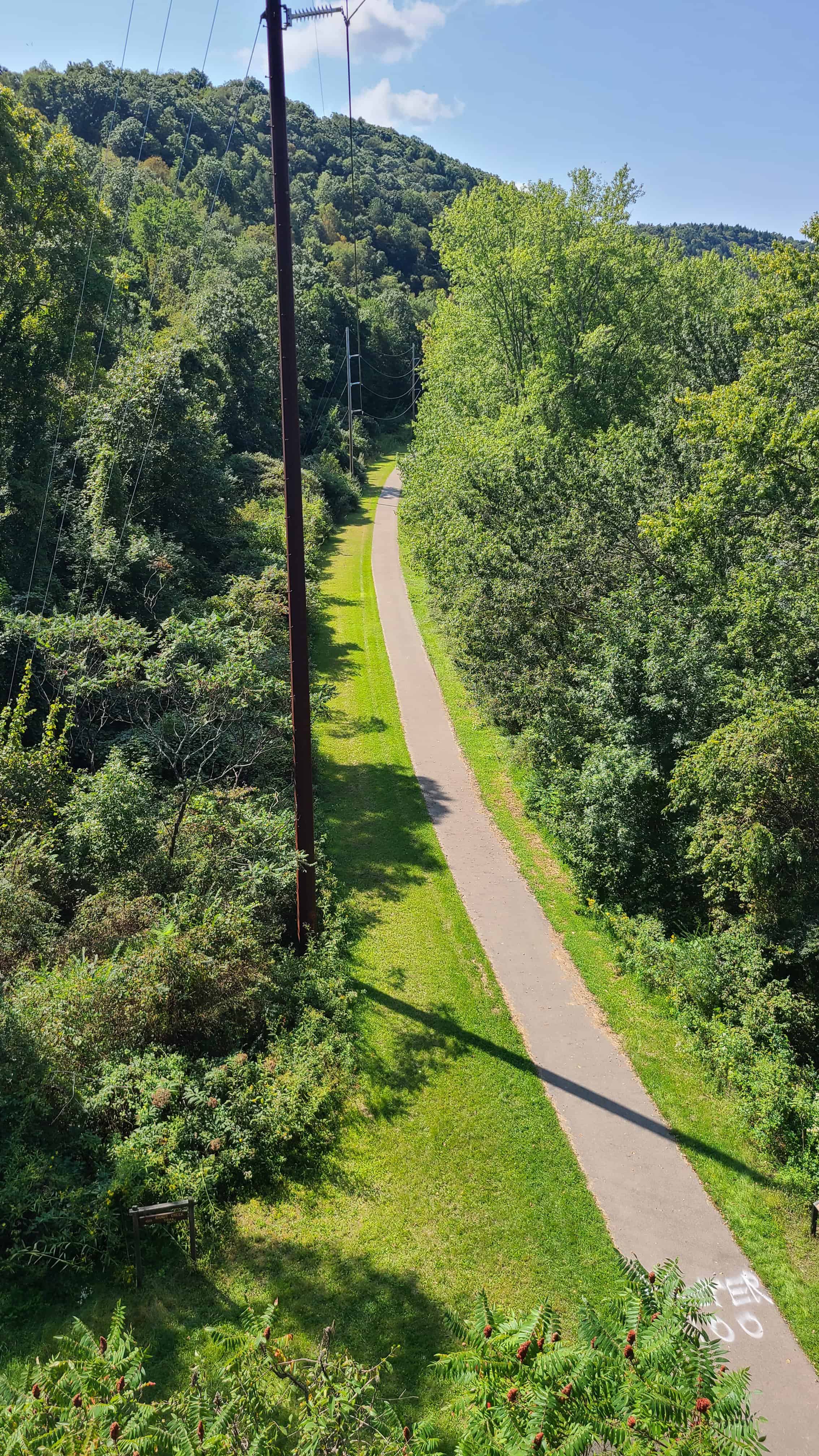
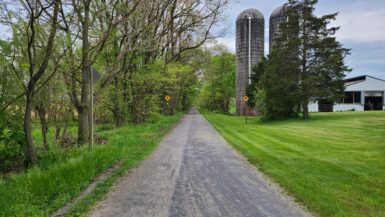
The trail is almost entirely paved and generally well-maintained. As with all paved rail trails, tree roots can be a problem in spots, especially towards the western end. I nailed on so high it sent my phone flying out of my mount and somehow managed to dislodge my pannier, which honestly is impossible. Personally I wish more trails would stick to gravel and packed dirt, but I understand the appeal.
Grade is very gentle and never exceeds 2%. This is well within the range of what a beginner can handle. If you’re at all concerned, start at the midway or western trailhead and ride east. When you get tired, turn around and enjoy the downhill cost back to base.
This is a remote trail, and both my Verizon and T-Mobile devices struggled to hang on to a signal. The only facilities are at the Belmar trailhead, where the trail crosses the Allegheny River (roughly 8 miles west of the Van trailhead). No other restrooms or water are available along the trail.
The Tunnel
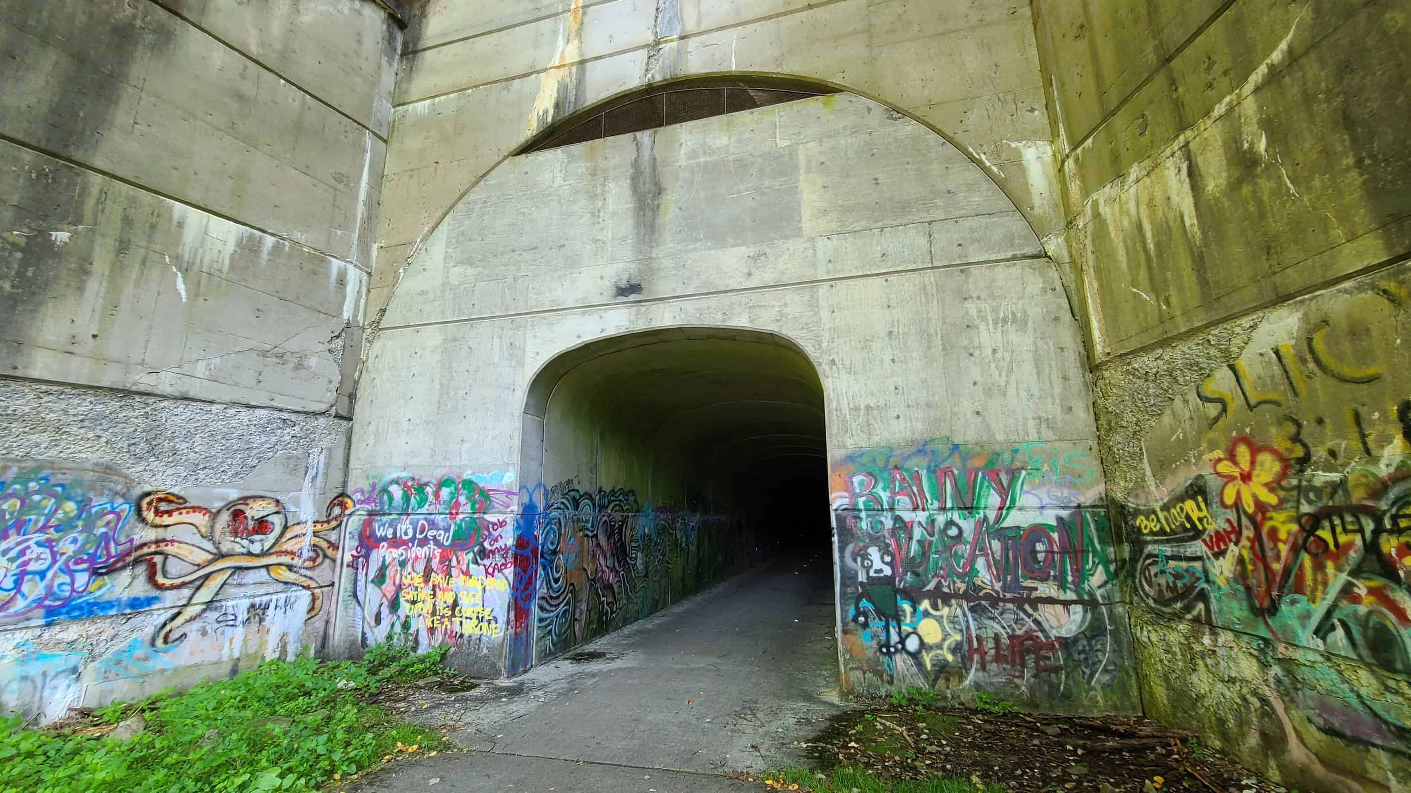
What has two thumbs and loves encountering tunnels on rail trails? This guy!
The Mays Mill Tunnel was in pretty bad shape when it was donated to AVTA. The Association struggled to find ways to rehabilitate the tunnel, but kept running into financial and historic constraints. Finally, a genius idea was born: build a second tunnel inside the first tunnel, and repurpose old tires — about a quarter million of them — to fill the void between the two.
The end result is a bittersweet thing of beauty. Although riders can no longer see the original tunnel’s structure, the new tunnel is safe and clean. As it stands today the tunnel is about 1000 feet long and completely unlit. You’ll definitely want a bike light.
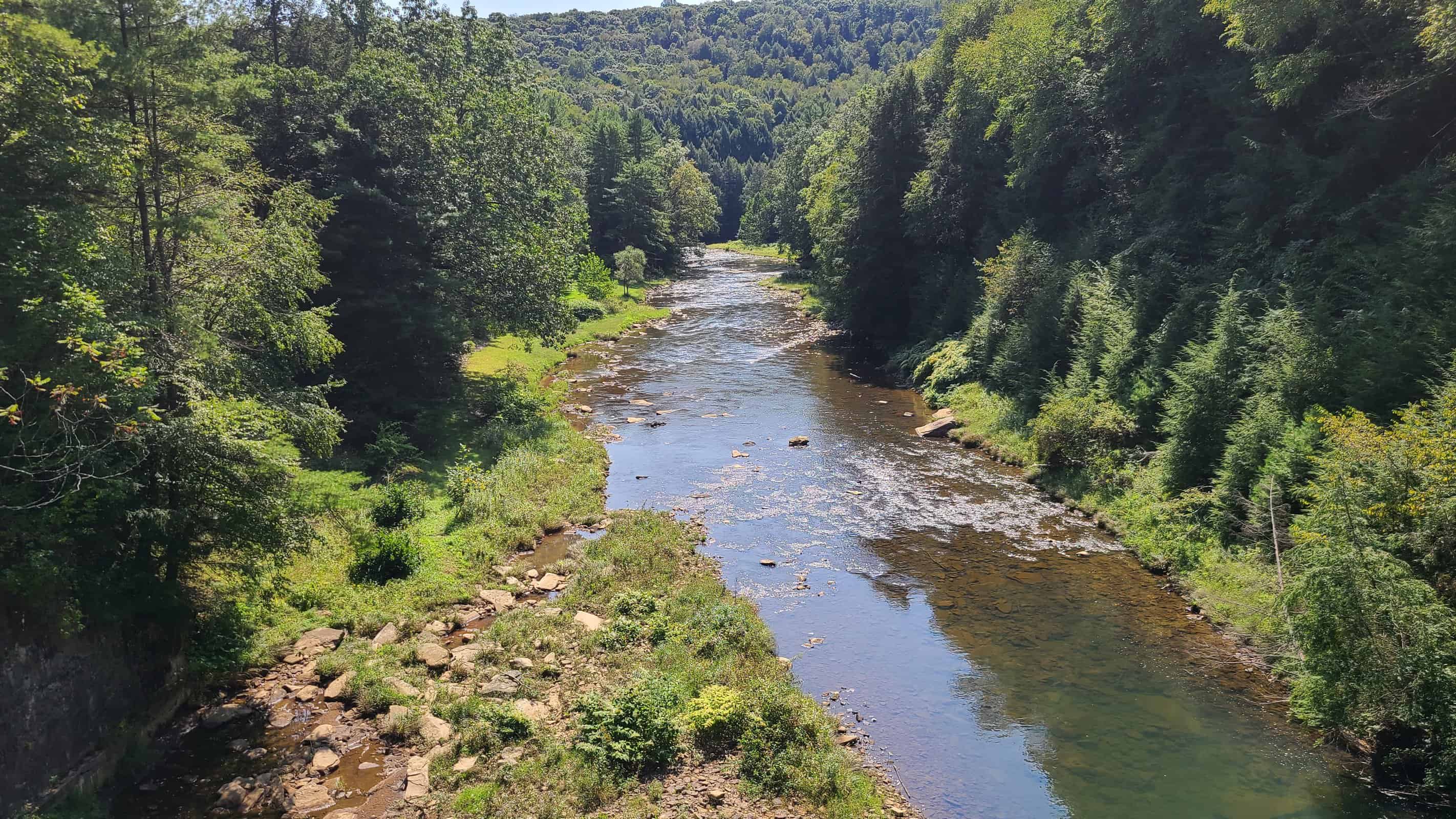
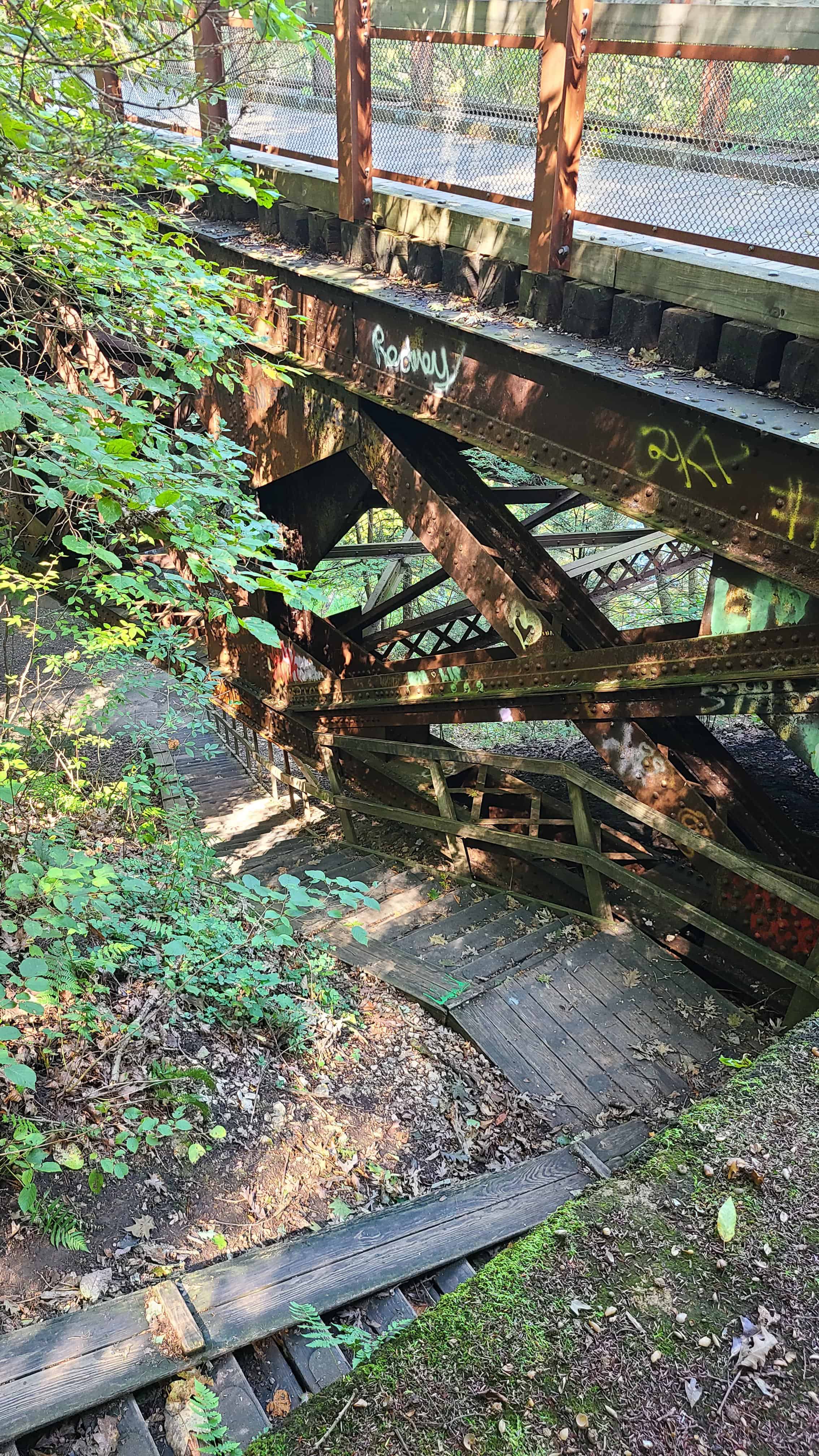
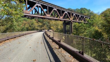
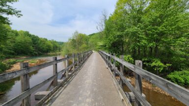
Let’s Talk About Those Bridges
I’m not normally one to get excited about bridges, but this trail crosses over no less than 7 bridges in the span of less than four miles. These allow for some breathtaking views over Sandy Creek:
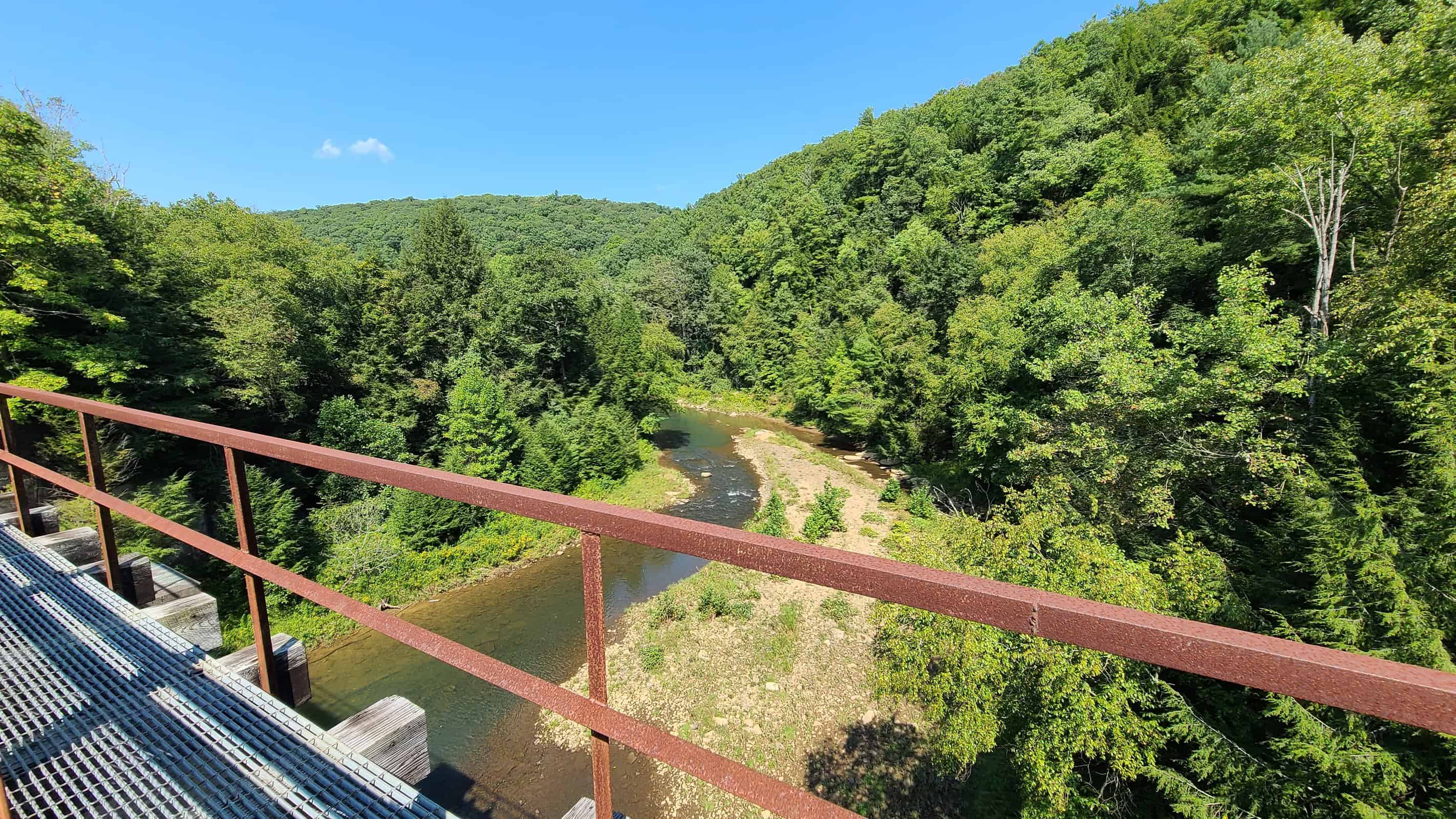
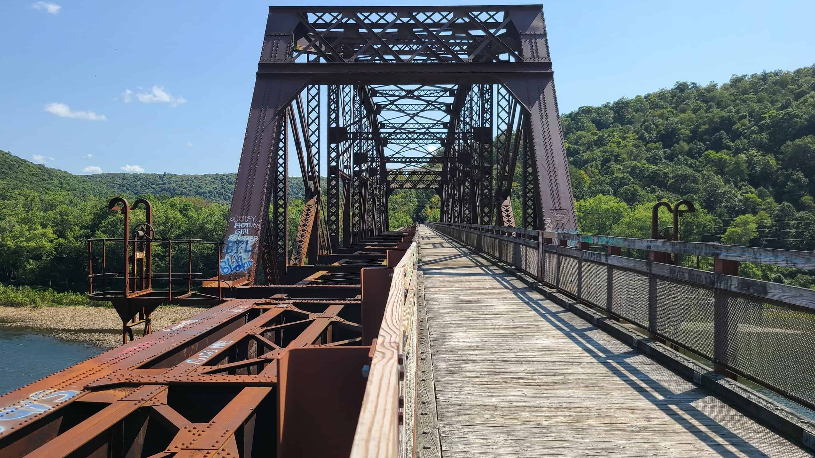
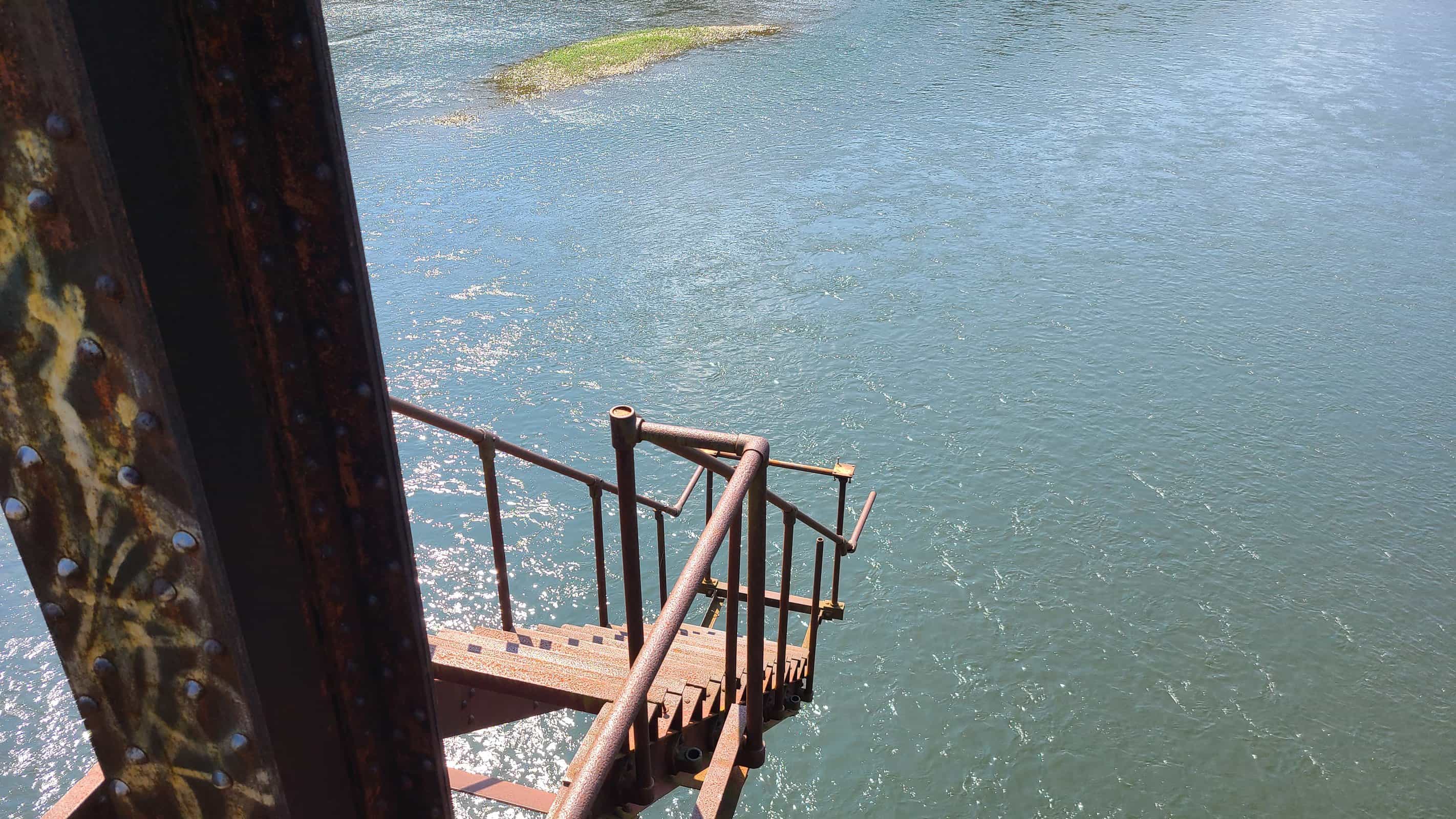
One of those seven bridges happens to be the 1300-foot Belmar Bridge. The Belmar Bridge was originally built for the railroad in 1907. When it was redecked in the early 2000s, many of its original industrial features were left in place. The result is rusty stairs to nowhere and winches whose original purpose is long forgotten. My best guess is that they were used for maintenance during the bridge’s service life.
This bridge also marks the Sandy Creek Trail’s intersection with the Allegheny River Trail. A set of stairs leads to a short connector between the two trails. From the top of the bridge, you get a good view of both trails.

Getting There
There are a few ways to access the trail.
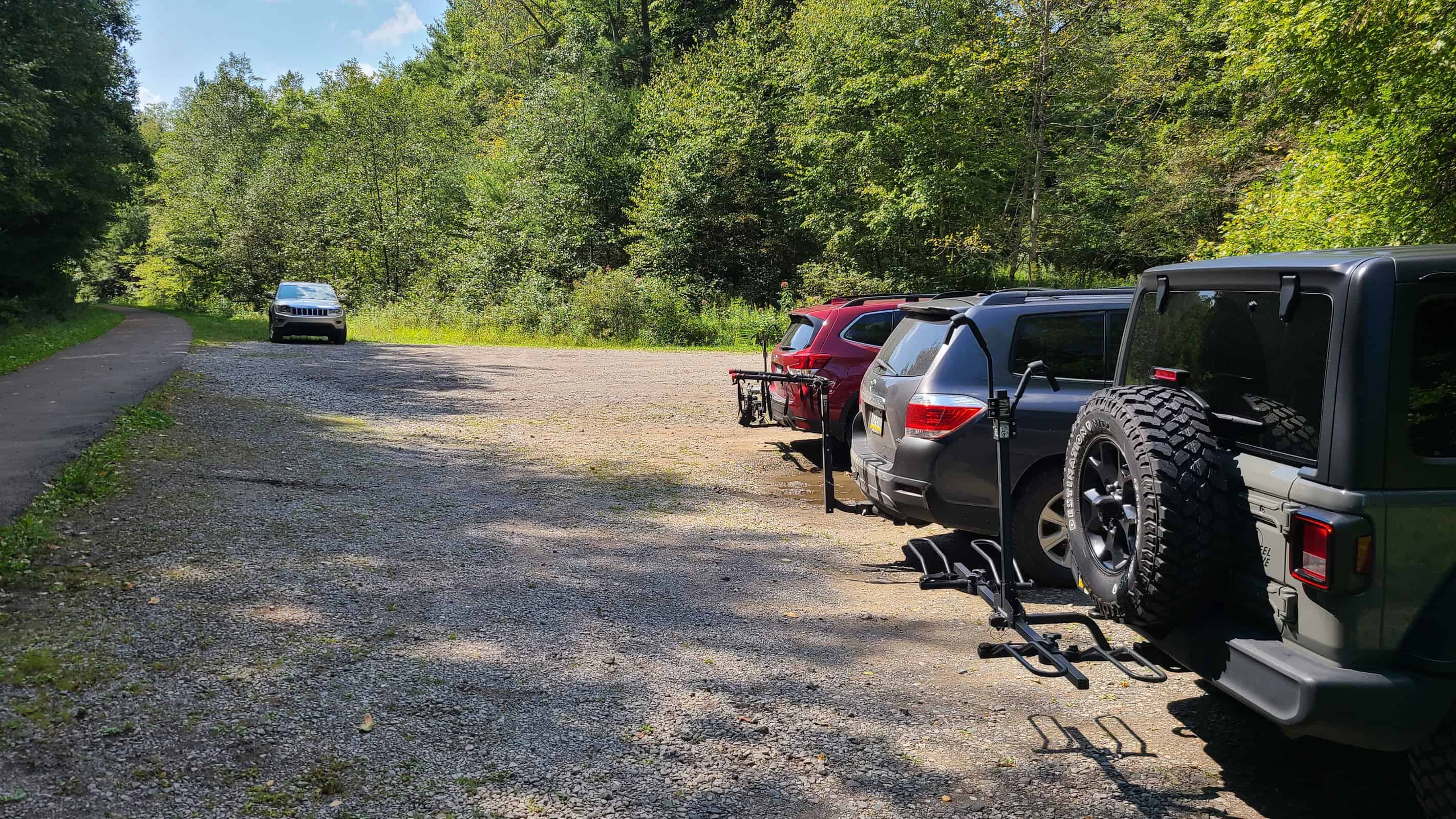
- The Van trailhead marks the eastern terminus of the trail. Getting there requires riding about a quarter mile along a rough dirt road. I parked next to a Prius when I arrived, so if they can do it, you can too.
- The Rockland Road trailhead gets you a lot closer to the action if you don’t feel like riding the full trail. You’ll miss out on a lot of the beauty east of here, but you’re only about four miles from Belmar Bridge.
- The Belmar trailhead is roughly two-thirds along the trail heading westbound. This starts you off immediately adjacent to the Belmar Bridge. There are reportedly restrooms at this trailhead, but I haven’t verified this.
- The western trailhead is Fisherman’s Cove Road. Unless you’re familiar with the area, stick to one of the two other major trailheads.
Conclusion
Some rail trails wind you through revitalized downtowns with brewpubs and coffee shops. Some rail trails take you on a peaceful, quiet ride through the woods. Sandy Creek is definitely the latter. It’s an easy and very accessible ride with lots to see and enjoy along the way. Just make sure you’re loaded up on water and know how to fix a flat before you go.
Official website: https://www.avta-trails.org/sandy-creek-trail.php
Traillink profile: https://www.traillink.com/trail/sandy-creek-trail-(pa)/
Photos of Mays Mill Tunnel: https://taimages.railstotrails.org/3-Rail-Trails/Sandy-Creek-Trail-Tunnel/i-9Nh3J3g

Leave a Reply